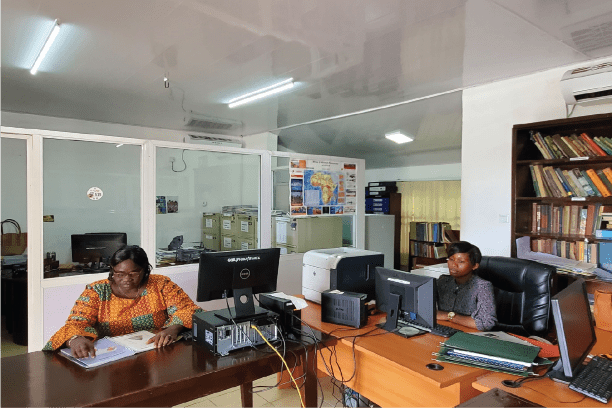
Geodata & Information Services

The National Minerals Agency is the principal custodian of nationwide geoscientific data information on behalf of the Government of Sierra Leone. The Agency is continuously working with its many stakeholders, and more especially our development partners to improve on the geoscientific know ledge of the country. Through funds from the World Bank, we have been able to carry out a nationwide Airborne Geophysical Survey with a team of firms and our subject matter experts at the Agency. The survey design was done by GeoFocus, survey and data processing was carried out by Xcalibur Airborne Geophysics (XAG) and Patterson Grant and Watson (PGW) did the interpretation. Reid Geophysics Ltd (RGL) did the QA/QC on the entire process from acquisition to final deliverables and report.

Below is a sneak peek of the deliverables of a nationwide coverage:

A more detailed Geology

Total Magnetic Intesity

RTEI-1VD on RTEI

Processed geophysical

Landsat True Colour Composite

Raw and Processed SRTM and Landsat8 Data

Radiometric Ternary

Kimberlite Targets

Mineral Favourability

3D Inversions

and so much more. Swipe the slider left and right to see the situation before and after the survey.

In addition to the deliverables from the recent nationwide surveys, we also serve a wide range of historic geoscientific data and information including but not limited to the following:

Geology and Mineral Map of Sierra Leone

This is available at a scale of 1:250,000. It is served in 4 map sheets.

Mineral Rights Map

This map is produced monthly and on needs bases. It shows the state of mineral rights licences in the country at a given time.

Strategic Mineral Map of Sierra Leone

This map shows the locations of proven mineral deposits in the country.

Bespoke client specific maps

We also provide bespoke services to clients at their request.

With the huge volume of  are currently working on developing an enterprise Geoscientific Information Management System (eGIMS) which will be a feature-rich portal for managing and delivering high quality digital geological, geophysical, geochemical, etc.  data and information and their related metadata catalog.

To be able to effectively and efficiently manage and serve the huge volume of data and information from historic and recent studies, we are currently working on developing an enterprise Geoscientific Information Management System (eGIMS) which will be a feature-rich portal for managing and delivering geological, geophysical, geochemical and other forms of geoscientific data and information and their related metadata catalog.

Acquiring Data & Information

To acquire geoscientific data and information services, clients must take an Order-to-Pay for the requested service and make payment at the bank. Once we receive proof of payment, we'll package the job and deliver. Fees for all historic data and information are found in the First Schedule - Fees, Expenditures and Penalties. Click link below to see the Schedule of Fees.

Contact us for further details

Other Services

Library Services

The library holds a huge volume of geological literature, bulletins, memoirs, short papers, maps, print and electronic journals, mining laws and documents to support bibliographical services to internal and external stakeholders.
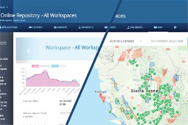
Mining Cadastre

The Mining Cadastre Office (MCO) is responsible for processing of mineral rights applications; the issuance and administration of licences and permits; the maintenance of cadastral records, registers and maps; etc.
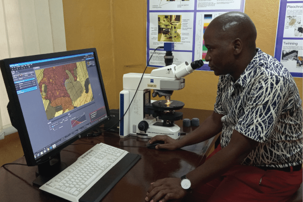
Laboratory Services

The Geological Survey laboratory is responsible for analytical services ranging from sample preparation, petrography, XRF and chemistry, mineralogy, environmental chemistry and sealing of samples for export.

If you like the information on this page, please feel free to share.

Share:

Facebook
Twitter
LinkedIn
WhatsApp